

Nearly 75% of residents regularly drive up to an hour to haul safe drinking water, making the cost of water over 700 times higher than in Phoenix or Las Vegas. As safe water resources are scarce, many rely on unregulated wells and occupy lands downwind of unmarked contaminants, as the risks of the landscape remain invisible.

The landscape of Cameron, AZ, is a shifting terrain of radiation, abandoned mines, informal and formal roads, wells, and livestock corrals.

A toolkit of strategies are used to address the spread of contaminants in air, water and soil. Landforming and planting redirect water and control migrating sediment, and monitoring strategies are deployed to make risk visible to surrounding residents.

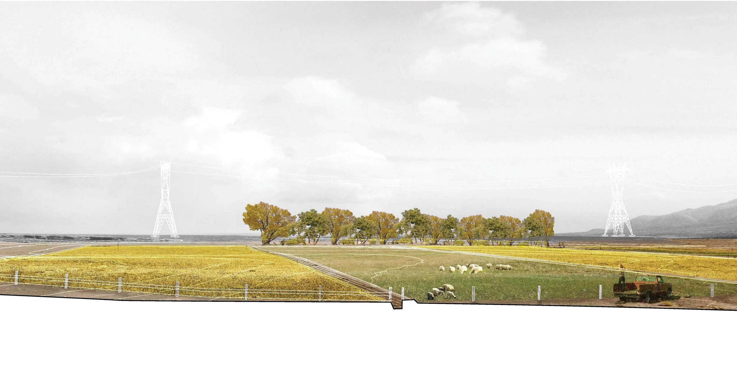
Contaminated minelands are repurposed with a rotational system of low-level uranium-extracting crops irrigated by water captured from flash storm events. Shelterbelts of deciduous cottonwood buffer both aeolian and subsurface contamination, and act as a bright marker of former mines.

Weirs capture clean water upstream of contaminanted soils, providing a water source for home gardens and watering hole for livestock. A shelter belt is planted downwind of mines to protect water from aeolian dispersal of contaminated soils, using evergreen trees and shrubs chosen for cultural use, viable building materials, and use for natural dyes for weaving.
![another new shelterbelt [Converted].jpg](https://images.squarespace-cdn.com/content/v1/5426ec9ee4b017861367b3ad/1532813962375-OP0VFE8K5QKU8VAM4G6R/another+new+shelterbelt+%5BConverted%5D.jpg)

Monitor wells track contaminant flow, direction, and groundwater quantities in alluvial and C-aquifer. Safe multi-level wells are converted to drinking wells; LED lights visualizes risk (yellow) or availability of groundwater in real time. At night, safe resources are visible from miles away.
